N GA/TN wildfires
Posted: Fri Nov 11, 2016 9:30 am
I went up yesterday afternoon, mainly to make sure cleaning the terminals on my voltage regulator had worked - good news is it apparently has for now.
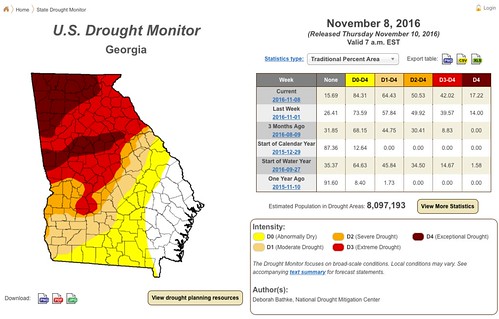
Since I was up, I flew over to where some wildfires are nearby - just west of Blue Ridge, GA. There are wildfires all over E TN and W NC as well - we have not had a substantial rain in ages and things are dry as a bone:
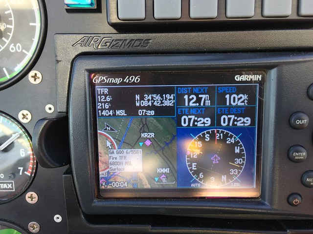
The TFR for firefighting just went up to 6,800' msl, so I thought an overflight at 7,500' would be kosher.
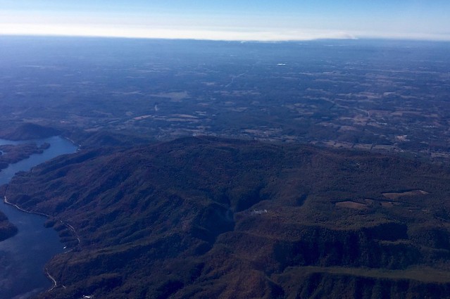
View to the west shortly after taking off from Copperhill:
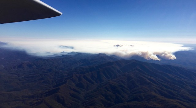
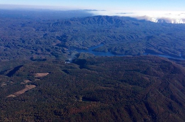
Approaching from the NW:

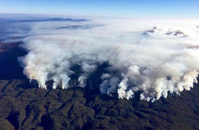
From 7,500':
Looking west towards Chattanooga, more fires over there:
For those familiar with the area, that's US64 running along Parksville Lake on the left.
In the photo, you might make out a small column of smoke on the ridge. Here's a better view:
After landing, I called the fire dispatcher and advised them of its location.
Anyway, a beautiful flight and now we just need some rain - desperately!
Since I was up, I flew over to where some wildfires are nearby - just west of Blue Ridge, GA. There are wildfires all over E TN and W NC as well - we have not had a substantial rain in ages and things are dry as a bone:
The TFR for firefighting just went up to 6,800' msl, so I thought an overflight at 7,500' would be kosher.
View to the west shortly after taking off from Copperhill:
Approaching from the NW:
From 7,500':
Looking west towards Chattanooga, more fires over there:
For those familiar with the area, that's US64 running along Parksville Lake on the left.
In the photo, you might make out a small column of smoke on the ridge. Here's a better view:
After landing, I called the fire dispatcher and advised them of its location.
Anyway, a beautiful flight and now we just need some rain - desperately!